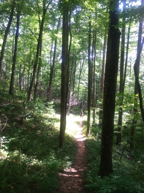
 Several weeks ago I visited a trail that I learned about from a great new book collecting 35 trails in and around Asheville. The author is Jennifer Pharr Davis, who took on the entire Appalachian Trail solo at age 21; since then, she has hiked the AT twice more, setting endurance and speed records. She is going to be a guest of The Compleat Naturalist (where I work) Friday, Nov. 15, to speak as part of our “Meet the Naturalist” series.
The trail I chose to explore is called the Coontree Loop. It’s actually what Pharr Davis calls a “balloon,” which means there is a “string” that you hike in on, and then the trail divides into two directions. I went left, at the book’s suggestion, so that the grade would not be as steep heading up to the ridgeline.
One of the great things about this little hiking guide is that it shows a diagram of each hike’s elevation gain. This one is basically a typical bell curve: the hiker starts out going up up up, and finishes going down down down.
Something else that sets Five-Star Trails: Asheville apart from other area guides is that all the trails are rated for scenery, condition, difficulty, solitude and appropriateness for children. Also provided is a list of which of the 35 hikes are best for: convenience, geology, history, kids, scenery, seclusion, waterfalls, wildflowers and wildlife.
 Pharr Davis divides her book into geographical sections: Central, North, East, South and West. Coontree Loop is in the South section and is part of Pisgah National Forest not far from the town of Brevard. It is accessed across US 276 from the popular Coontree Picnic and Parking Area, which is right beside picturesque Coontree Creek, also visible from much of the loop itself, along with another small mountain stream.
The weather was perfect for mid summer and the dense canopy on this trail provided a natural cooling system that comforts the ascending hiker. However, I was thankful that I had chosen to bring along my Camelback to stay completely hydrated during the somewhat strenuous climb.
One of the mild disappointments of hiking the Coon Tree Loop in summer is that after one has ascended approximately 1,000 feet, the reward of a sweeping view of the landscape below is never delivered. The upper part of the trail is a wooded ridge, whose overlooks of Chestnut Knob and Black Mountain are only easily visible during winter.
Going downhill is always easier for me than up, but for those with knee concerns, this trail may not be the best choice. Pharr Davis warns that during rainy periods the descent can be tricky due to some erosion; she suggests bringing hiking poles.
While I’ll never have the endurance of a Jennifer Pharr Davis, I am thrilled that I can tackle a trail with the short but steep elevation gain of Coontree Loop. As I write this, exactly 30 years ago this week I was on a respirator in an intensive care unit in Kansas, having had a code blue – I stopped breathing following an asthmatic episode. For years after that I was on many asthma meds and rarely walked far. Today I take only seasonal allergy meds, keep a mostly unused inhaler on hand and get out in nature and hike as much as I can.
I’ll remember Coontree Loop as a beautiful short trail providing a nice, steady workout. Wading in the rocky Coontree Creek at the picnic area is an exhilarating way to cool off and relax after the hike.
Distance traveled: 3.7 miles
Difficulty: Moderate to strenuous with some erosion
Flora of note: sycamore, beech, hemlock, mountain laurel, rhododendron, several fern and moss varieties, oyster mushrooms, red brick top mushrooms, Heal All or Prunella Vulgaris
Some photos by Nate Miller


Recent Comments